Use scroll bars to navigate map.
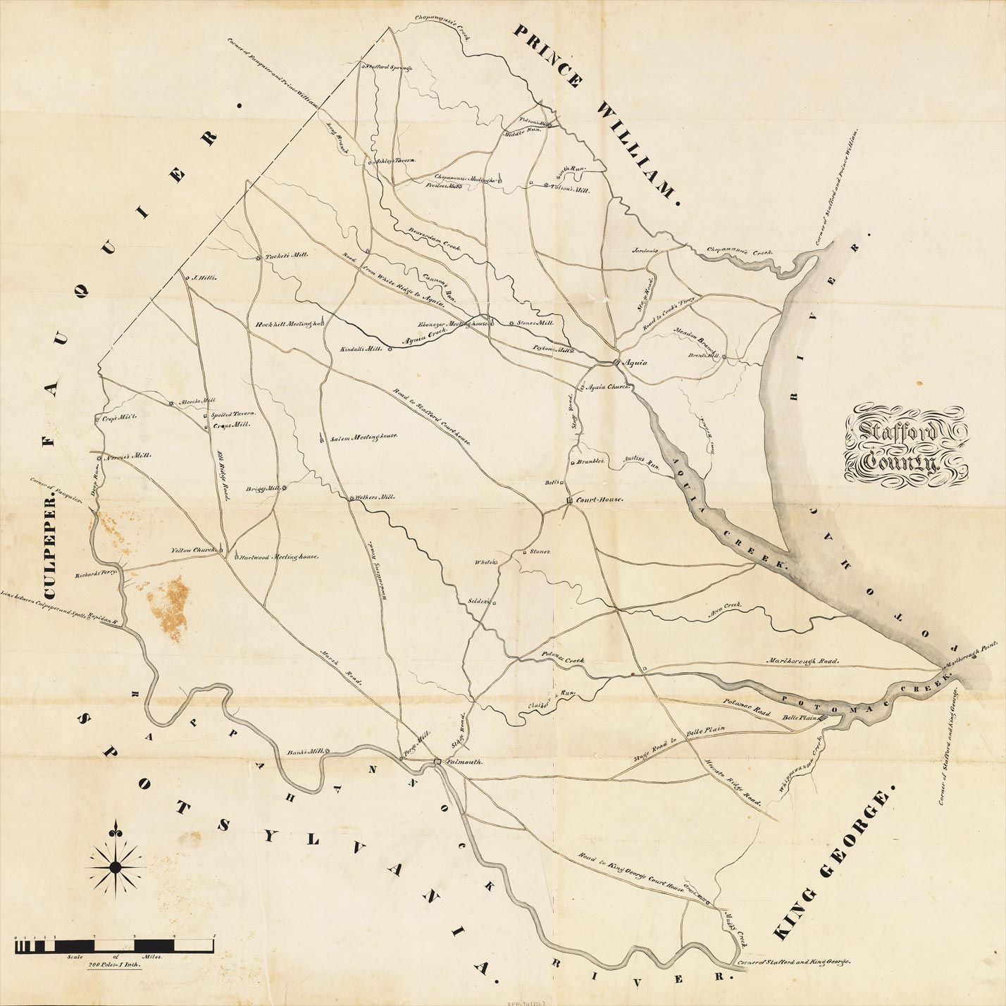
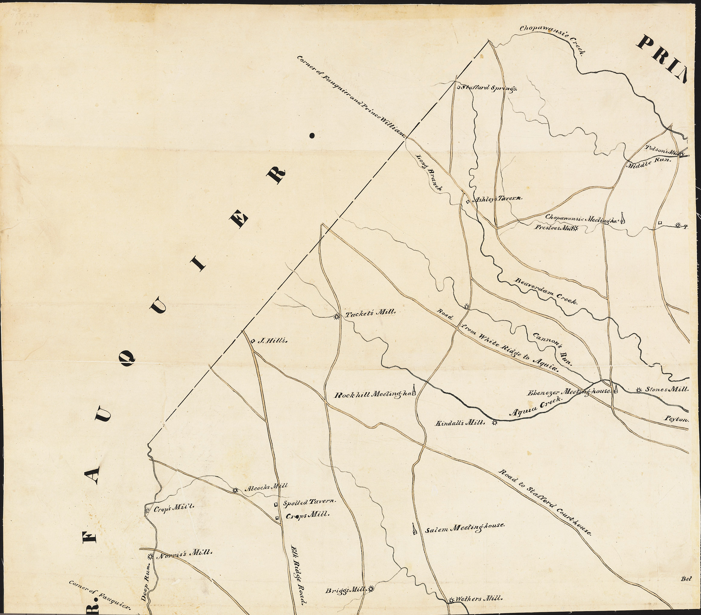
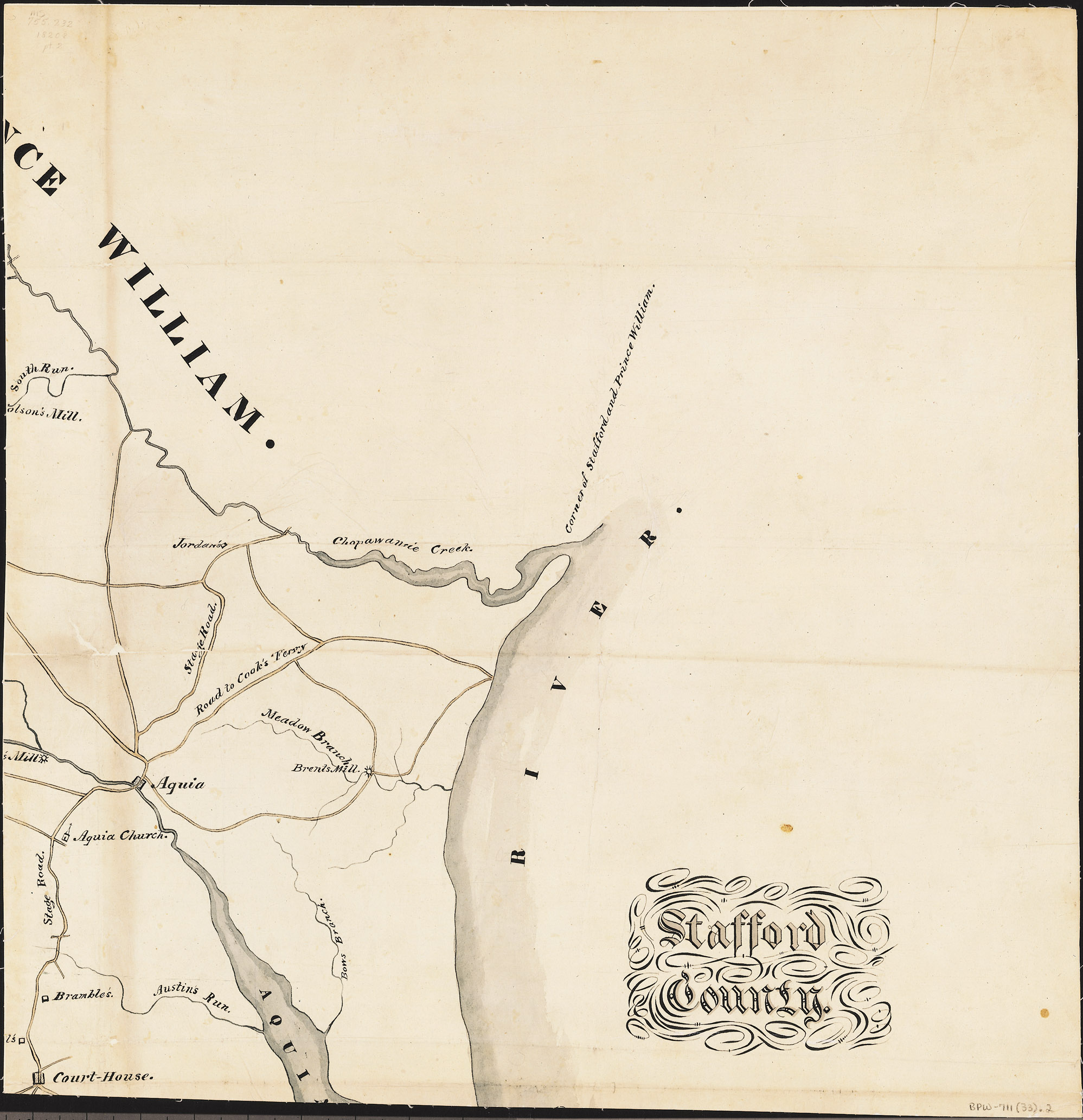
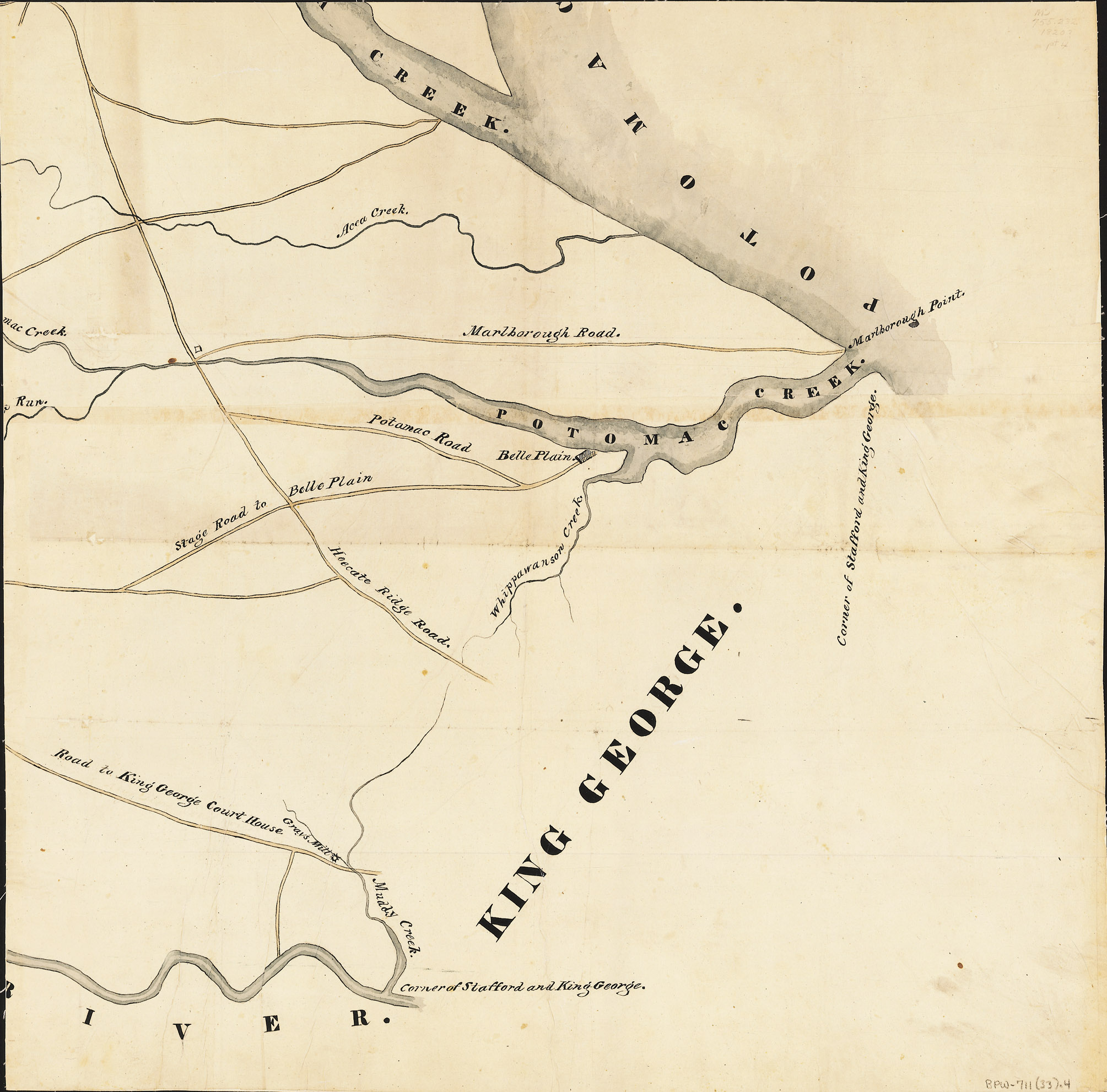
Note: Digital map assembled and retouched for exhibit from map scans provided by The Library of Virginia. [Wood-Boye maps, Stafford. [1820?]. Scale: 200 poles = 1 in. [1:39,600]. 4 parts. 42 x 48 in. Digitized microfiche. Board of Public Works entries 711-712, The Library of Virginia]